INTRODUCING
NEER
An advanced water sampling payload designed to transform any UAV into an autonomous environmental monitoring station.
We don't just solve the problem; we are redefining the ecosystem. AkashPankh is an autonomous flying laboratory designed to reach where humans cannot, delivering scientifically verified, legally admissible water quality data.
Where we deploy to solve the ground reality.
Autonomous sampling at chemical discharge points and hazardous effluent outlets where human access is dangerous.
Rapid scanning of pollution hotspots in cities like Varanasi and Kanpur, tracking sewage inlet points with GPS precision.
Reaching upstream sources and flood channels that boats cannot navigate, ensuring complete river system coverage.
An advanced water sampling payload designed to transform any UAV into an autonomous environmental monitoring station.
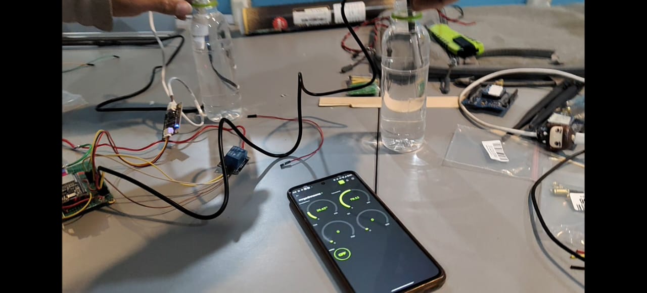
A proprietary workflow combining robotics, micro-fluidics, and IoT to ensure sample integrity.
GPS Lock & Hover Descent
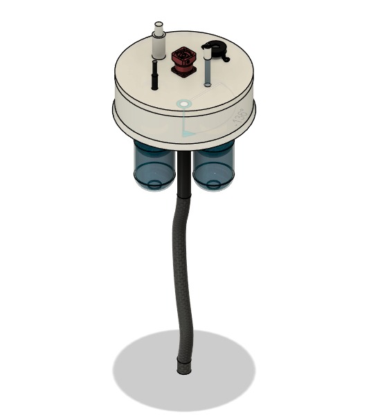
Rotary Chamber & Multi-Sensing
4-Bottle Rotary Mechanism
Redundant Cloud Upload
The drone descends to exactly 0.3m - 1m above water level. The ESP32 captures the GPS coordinates at the exact millisecond the pump activates.
Water enters a custom 300ml rotary chamber. Integrated sensors instantly analyze 6 parameters before the sample is even bottled.
A stepper motor rotates the inner chamber. When aligned, gravity fills specific bottles sequentially.
Dual-path redundancy ensures data safety. GSM for speed, LoRaWAN for range.
Breaking the barriers of traditional sampling with first-in-class features.
Unlike standard drones, our ESP32 captures the geotag at the exact millisecond of pump activation. This removes "drift error," creating 100% legally admissible location data.
A stepper-driven rotary chamber ensures the sample is isolated, tested, and bottled without mixing. 4 distinct samples from 1 flight mission with zero cross-contamination.
Failure is not an option. We use 4G/GSM for speed (2-5s latency) and auto-switch to LoRaWAN (15km range) if the network fails, guaranteeing data integrity.
We don't just collect water; we collect proof. Every bottle is physically mapped to a digital ID containing Time, GPS, Depth, and Sensor Data.
Transforming water quality monitoring from a manual liability to a digital asset.
From the drone to the Ministry, data flows instantly to the right decision-makers.
Engineering the future of environmental compliance.

Team Lead & Strategy

Software Architect

System Design

IoT Integration

Product Design

Electronics Engineer
We are ready for pilot deployments. Reach out for technical demonstrations or partnership inquiries.